Environmental early warning powered by satellites
Allerta.AI blends IoT sensors and Copernicus (Sentinel) observations with AI models to predict and notify, in advance, critical air‑quality events and extreme weather conditions, both indoor and outdoor.
Timely alerts
Reduce reaction times thanks to intelligent notifications on thresholds, trends and predicted scenarios.
Satellite correlation
Integration of Sentinel‑5P (NO₂, SO₂, CO, O₃), Sentinel‑3 and weather data to validate and improve accuracy.
Reliability & security
Scalable cloud architecture, MFA and RBAC for secure, multi‑tenant data management.
How it works
Three layers turn raw data into action: Data Fusion → Pattern Recognition → Predictive Modeling.
Data Fusion
Spatio‑temporal alignment of IoT sensors, Sentinel and weather data. Normalization, quality checks and geo‑correlation.
Patterns & Transport
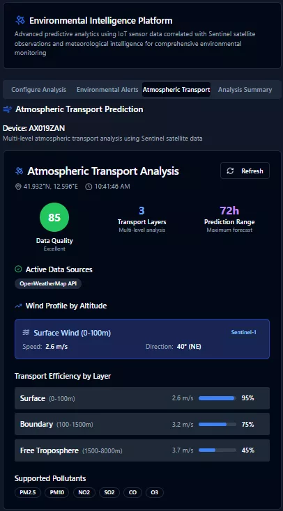
Anomaly detection and pollutant transport forecasting (3–8h) using wind profiles and atmospheric stability.
Decision Layer
Severity classification, confidence scoring and actionable recommendations for HSE managers and Civil Protection.
Platform modules
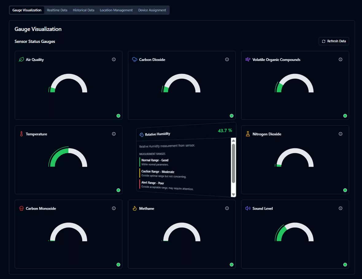
IoT Monitor & Live Alerts
Real‑time monitoring of indoor/outdoor devices, dynamic thresholds and alert dashboards.
- Device assignment and 3D map
- Critical alerts, warnings and recommendations
- Event history
Environmental Intelligence
IoT‑Sentinel correlation, transport forecasting and regional episodes with scientific insights.
- Satellite‑enhanced mode
- Wind‑profile analysis
- Confidence scoring
Weather & Location
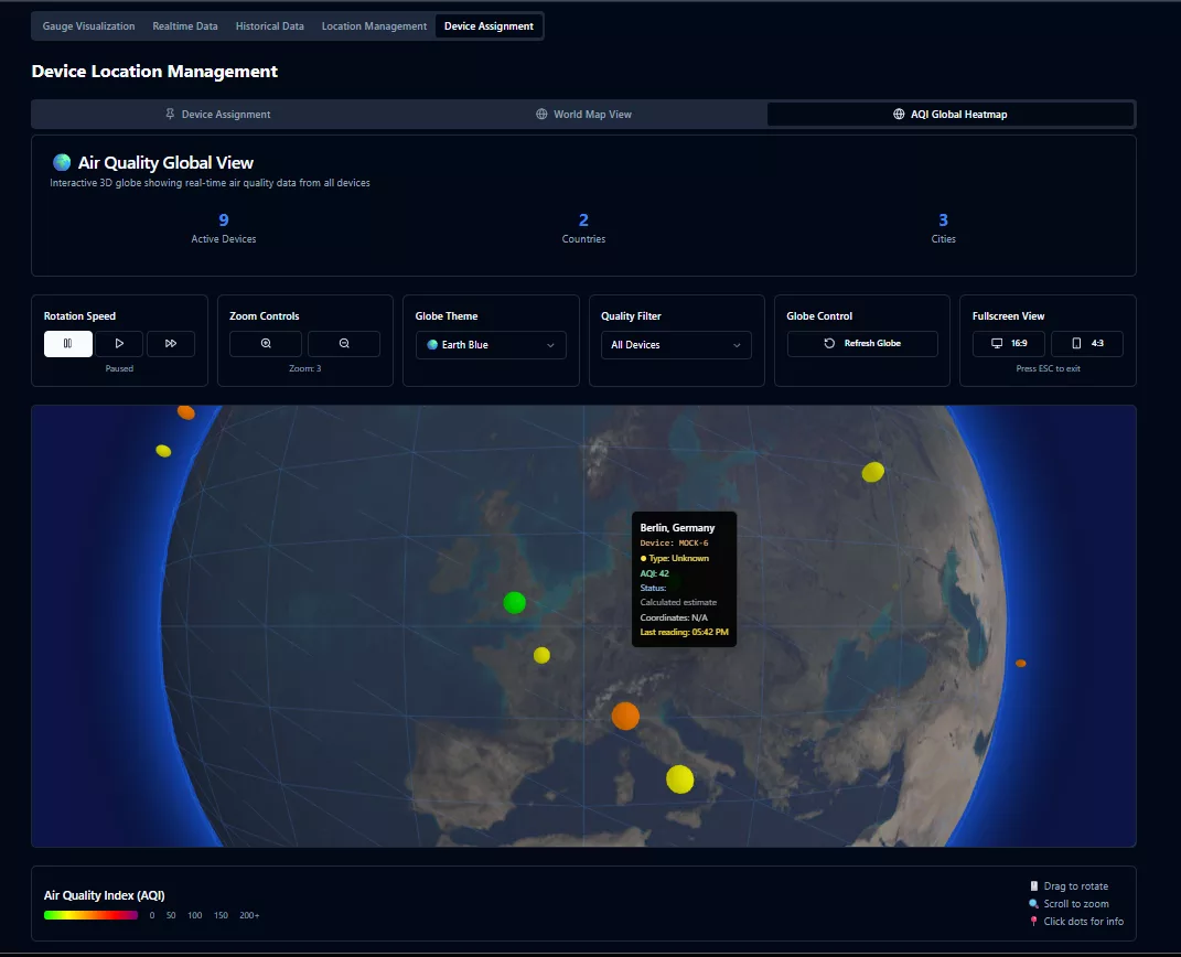
Operational weather data and globe view with air‑quality heatmap and device status.
- Operational OpenWeather
- AQI heatmap
- Sites/tenant management
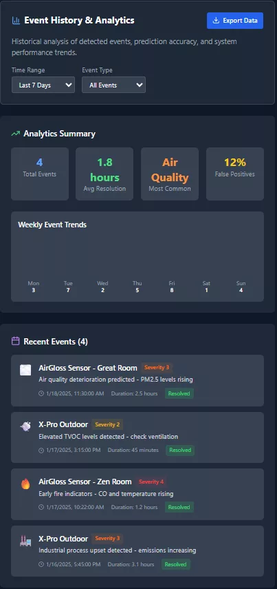
Analytics & History
Multi‑parameter trends, data export and accuracy KPIs for continuous validation.
- Annual/daily trends
- CSV download
- False‑positive metrics
Multi‑sector
Industry, smart buildings, schools, healthcare and public administration. Models and thresholds adaptable to the context.
- HSE profiles
- Custom thresholds
- Multi‑channel notifications
Space Connection
Operational use of Copernicus data: Sentinel‑1/3/5P to detect plumes, inversions and mixing.
- NO₂, SO₂, CO, O₃, CH₄
- Aerosol index
- DEM/land‑use integration (opt.)
Product Tour
A look at the main application views.
Bring early warning to your organization
Rapid deployment, integration with your sensors and enterprise‑grade security policies.

Contact
Do you want to evaluate a pilot or a proof‑of‑concept? Write to us and we will reply with an actionable proposal.
- ✉️ connect@synapsysrobotics.com
- 📍 Lazio, Italy — national and cross‑border deployments